By Caroline Laidlaw
My grandfather, Robin Laidlaw, owned Somerton in 1959, when the skeletons were found. I was 3 years old at the time, but have very strong memories of it. My father, Tom Laidlaw, lived at Abbey Lodge at the time and that is where I grew up until we moved into Somerton.
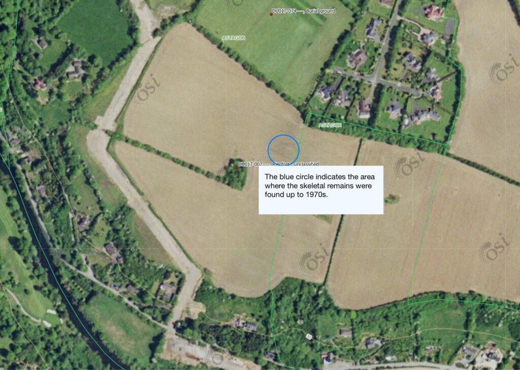
My father had taken over the farm and he was modernising it in 1959 and he began to reclaim the area that I have marked in blue below. This is when the skeletons were found. I am not aware of any serious excavation being carried out, but I do know that the National Museum were called out. Eventually the skeletons were buried in the Church of Ireland graveyard at Mulhuddart. This was often spoken about in my youth. I don’t know if the grave is marked.
From what I recall we were told that the bodies were buried in shallow graves. They were slight skeletons and were described as being those of women and children. The interpretation at the time was that their men were away fighting at the Battle of Clontarf – probably a rather fanciful view.
For the next 20 years, every time the field was ploughed, bones and teeth (I don’t remember any skulls!) would appear on the surface of the earth, in the area, which I have marked in a blue circle below. We used to collect them as children and we had bowls full of bones, until my mother threw them out! I think I might still have one tooth!
The field was used as a short cut from Porterstown to the Wren’s Nest pub, but prior to its reclamation, it had a terrible reputation for being haunted and people did not like walking through it after dark. The discovery of the skeletons justified their fears. There were “slips” from our land to both the Wren’s Nest and to the Strawberry Hall pubs for those taking a cross country route to the pubs.
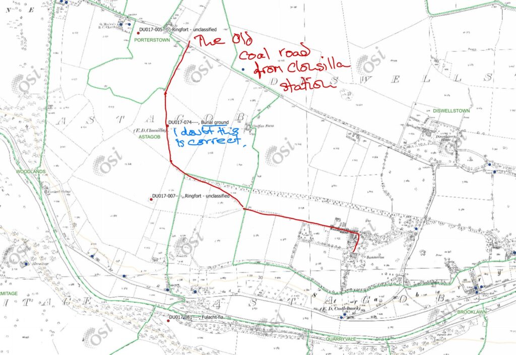
The Sites/Monuments Historic Environment Viewer (link below) incorrectly records the site, to the north of our property, on another farm – unless there was a separate archaeological site found there, which I am unaware of. I think it is wrong.
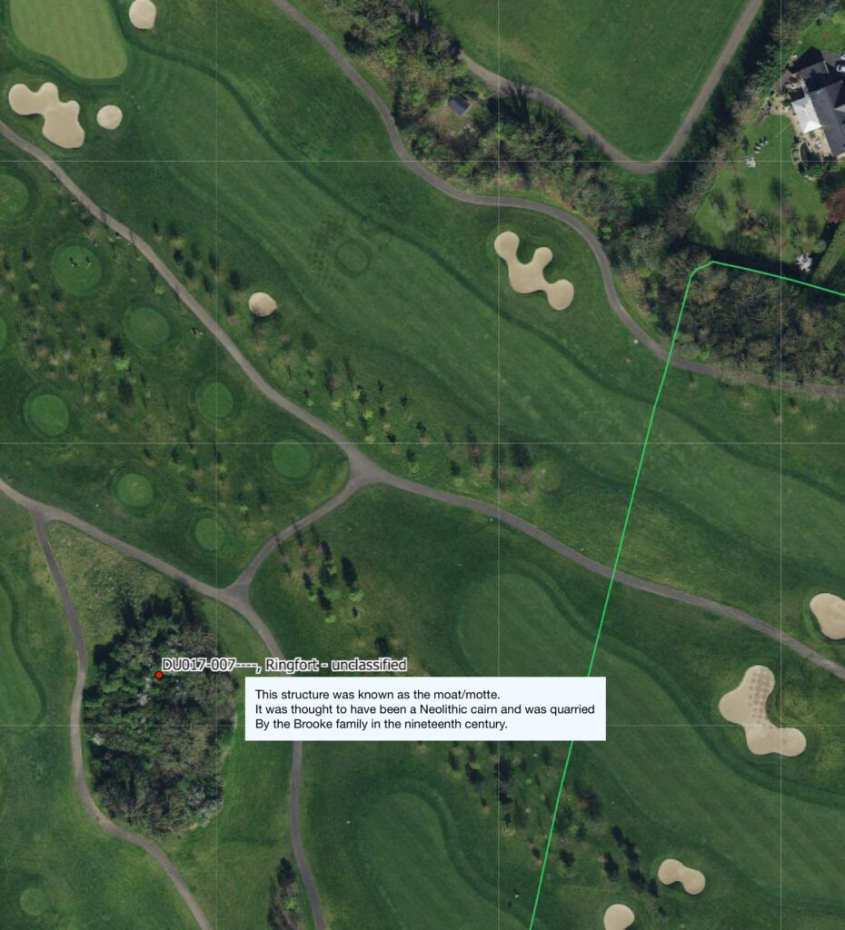
The “ringfort” which we called the “moat/motte” is immediately to the south west of skeleton site.
Historic Environment Viewer: https://heritagedata.maps.arcgis.com/apps/webappviewer/index.html?id=0c9eb9575b544081b0d296436d8f60f8